U.S. Geography: How the Land Shaped a Nation
From coastal ports to mountain valleys, geography has always been a silent actor in America’s story.
The Dive
The story of U.S. history begins long before 1776. Indigenous peoples thrived on this continent for thousands of years, building vibrant cultures shaped by geography. The Iroquois Confederacy governed fertile woodlands, the Pueblo built irrigation systems in the desert, and coastal tribes relied on fishing.
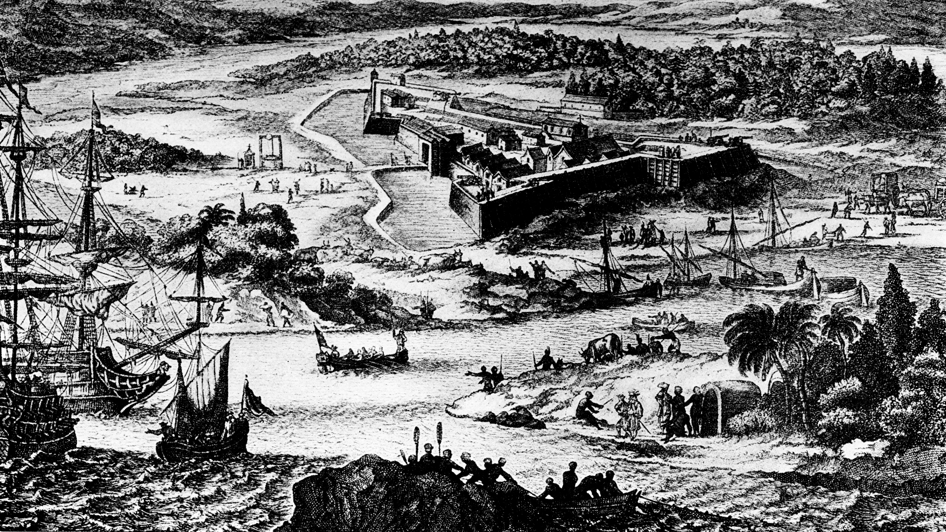
European exploration and colonization transformed North America. The Atlantic coastline, with its many natural harbors, encouraged settlement and trade. The Spanish settled the Southwest and Florida, the French moved along the Mississippi River and Great Lakes, and the English colonies stretched across the Eastern Seaboard. Each group adapted to the land they encountered and used geography to their advantage.
Three major geographic regions dominate the United States: the Coastal Plains, the Interior Plains (including the Great Plains), and the Mountain West. The Appalachian Mountains created a barrier to early colonial expansion, while fertile soil in the Piedmont and Coastal Plains supported tobacco and cotton economies. Rivers like the Mississippi became lifelines for commerce and culture.
Geography shaped not only economies but also cultural divides. Plantation agriculture flourished in the South’s long growing seasons, while rocky soil in New England pushed settlers toward shipping, trade, and industry. These differences created contrasting societies whose tensions would one day erupt into the Civil War.
The push westward revealed how geography directed history. Settlers crossed the Appalachians into the Ohio River Valley, then moved across the Great Plains, drawn by farmland and railroads. The Rocky Mountains and deserts slowed migration, but gold strikes and railroads overcame even those natural barriers. The geography of abundance—and challenge—fueled America’s identity as a frontier nation.
Geography also influenced wars and diplomacy. Control of the Mississippi River was central to both French and American strategies. The Atlantic Ocean shaped foreign policy, protecting the colonies from immediate European retaliation but later drawing the U.S. into global conflicts. From the Erie Canal to the Panama Canal, Americans have long reshaped geography to serve their ambitions.
In modern times, geography still matters. Coastal cities like New York, Los Angeles, and Houston thrive on global trade. The Great Plains remain America’s breadbasket, while the Mountain West attracts tourism and energy industries. Even today, natural disasters—hurricanes, droughts, wildfires—remind us that geography continues to shape how Americans live and govern.
Why It Matters
Mountains, rivers, plains, and coasts shaped how people settled, fought wars, built economies, and created cultures. Understanding geography helps us see why history unfolded as it did and how the land continues to shape America’s identity today.
?
How did geography influence the differences between Northern and Southern colonies?
Why was control of the Mississippi River so important to early U.S. history?
In what ways did mountains and rivers slow or speed up westward expansion?
How did Native American cultures adapt to different geographic regions before European colonization?
What modern challenges show that geography still shapes American life today?
Dig Deeper
North America didn’t always have its familiar shape, nor its famed mountains, canyons, and plains: all of that was once contained in an unrecognizable mass, buried deep in Rodinia, a huge supercontinent that lay on the face of the Earth. Peter J. Haproff explains how it took millions of years and some incredible plate tectonics to forge the continent we know today.
Comparing the Lives of Native Peoples compares and contrasts the lives of early Native people’s in North America.
The 13 British colonies were founded from a desire to profit from land and resources. So how did their varied geography shape their growth?
Related
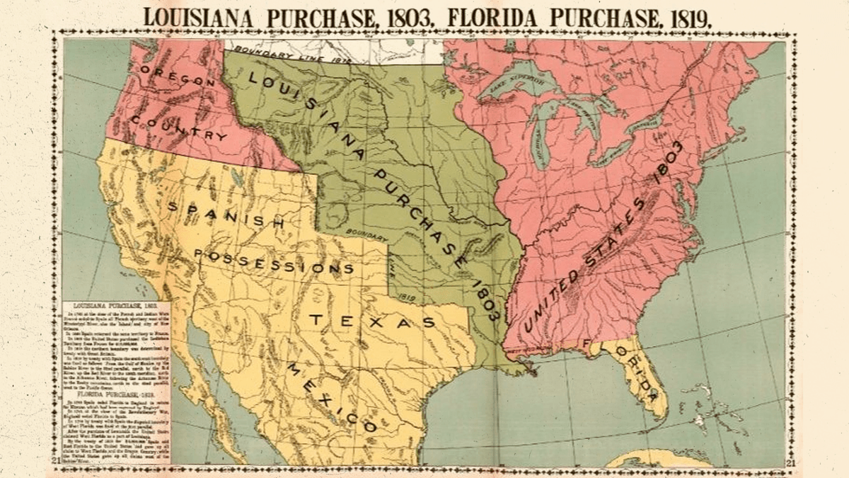
The Louisiana Purchase: A River, A Bargain, and a Bigger United States
In 1803 the United States bought the vast Louisiana Territory from France, doubling the nation’s size, securing the Mississippi River, and setting the stage for westward expansion and hard questions about slavery and Native sovereignty.
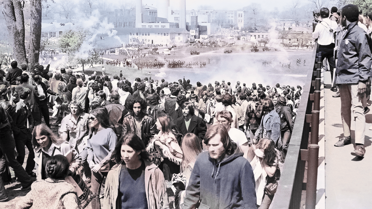
Kent State Shootings: When Protest and Power Collided
A moment when the Vietnam War reached American soil—and exposed the deep divisions within the nation.
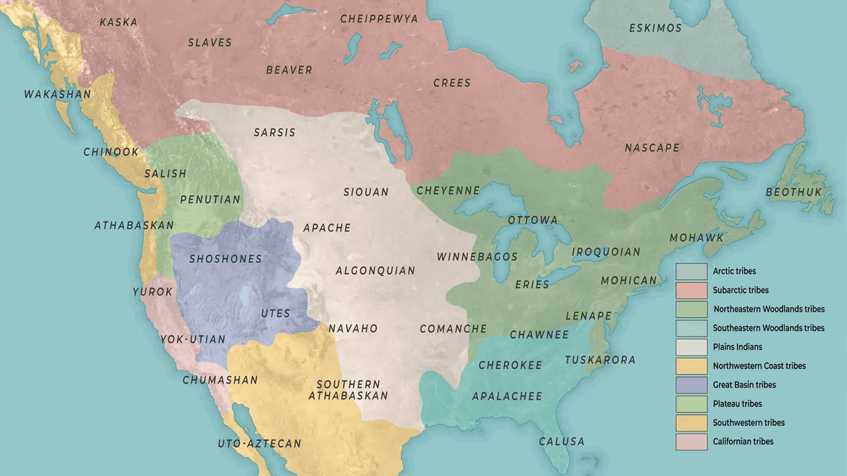
Indigenous Nations Before European Contact
Long before Columbus, Indigenous nations flourished across North America. From hunters following mammoths to farmers building vast trade networks, Native peoples shaped the land—and the land shaped them.
Further Reading

Stay curious!